More Driving on the Edge
Sometimes we fail to complete what we start. As sure as this is a universal truth it is probably more true of me than most. I failed to complete my perimeter drive around the USA in 1997 but now, in 2003 I'm going to try to finish it. Same car but now with almost 100,000 miles on it. Same me with a lot more wear and tear and a bit less hair. New camera. New computer.
I can already feel the differences between then and now beyond those associated with the passage of time. The first time I was the very definition of "free and easy": no house, no obligations, a good bank balance, and no real reason to plan anything or hurry anywhere. Now I'm saddled with a house and the obligations and worries that it brings. For that reason I'll be a bit less loose about the completion of the trip. But, the car and weather gods willing, I should finish up my trip at the tip of Maine in a reasonable time.
I'll be trying to keep a day-by-day log of the trip at the website rather than e-mailing as I did before. With luck there will be no problem adding at least a bit of the story every day. I drove from Knoxville, Tennessee to Savannah, Georgia on October 10th intending to restart the trip on the six-year anniversary of my original start from Alaska. As I write this introduction I'm sitting in a motel in Charleston, South Carolina having driven in from Savannah, Georgia today. That means that I'm already a day behind in my writing before I even start.
Day 1, October 11, 2003: Savannah, GA to Charleston, SC
↑ ↓ Not an auspicious start to the trip — I awoke to find that it had rained most of the night and that it had barely diminished. Never fear. The top of the Miata was still watertight after twelve years despite the fading color. On the bright side, at least the cost of traveling might be kept in check since the local fuel price was $1.29 which was a full $0.20 less that I had been paying in Knoxville.
I decided to make a few miles up the road before having breakfast but soon discovered that to be a mistake since eating places essentially vanished just north of the motel. Soon hunger overcame good taste and I stopped at a McDonalds. The neighborhood was pretty grim, the very poorest portion of Savannah I'd guess. At least the stop halted the stomach grumbles. And the rain seemed to be slacking off a bit more so it appeared there was hope for the day.
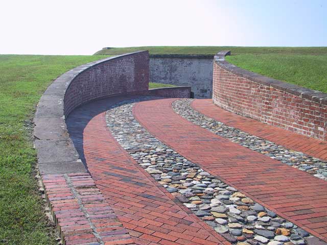
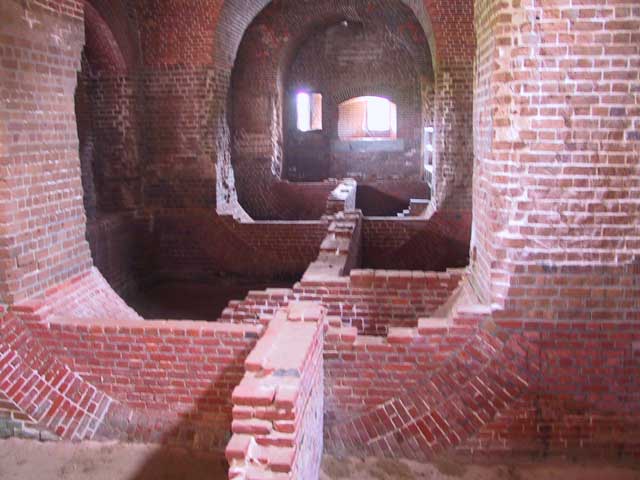 First touristing stop for the day was Fort Pulaski — one of the numerous coastal
forts constructed by the government in the first half of the nineteenth century. This one was notable in that it has a real
live moat around it. And the moat often had alligators in it if the rangers are to be believed. The alligators are supposed to
make their way up a gated canal from the river which is used to maintain the water level in the moat. Alligators or not it was
obvious that something was spooking the small fish in the moat which were often to be seen leaping from the water in
rapid hops clearly fleeing something. One hideous thing was to be seen: some sort of club of Chevy Avalanche owners was meeting
in the parking lot. To paraphrase Douglas Adams "Uglier things have been reported but not by reliable observers". Why anyone
would own a vehicle that is both ugly and wasteful is beyond me.
Further up the road and finally into South Carolina. Stopped for a few minutes at Pinckney Island Wildlife Refuge to eat a sandwich that I had picked up in Hilton Head. That locale proved to be a total waste of time since it was all locked up in private (and rather hostile) ownership and it wasn't possible to see anything beyond expensive homes, or at least the gates across driveways presumably leading to expensive homes. Certainly not a single view of the water to be had. Come to think of it, I haven't had a real view of the Atlantic Ocean since starting out. Rivers, estuaries, bogs, swamps, and similar things but no discernable ocean . Oh well. At least the weather cleared up enough to allow me to put down the top.
Had a terrible time finding an affordable room in Charleston and I almost thought I'd have to keep driving up the coast. It finally sunk in that this was a resort area and they were for some unfathomable reason committed to charging weekend tourist rates though there were no tourists (beyond me anyway) to be seen. Maybe that situation will get better after the weekend. Let's hope so anyway.
Just one picture today. This shows the complex brick construction used at the fort which allows it to remain stable right up to the present on sandy wet soil. Notice that the arches are symmetrical and extend below what would normally be the floor level revealing something which looks a bit like an aircraft fuselage.
Day 2, October 12, 2003: Charleston, SC to Wilmington, NC
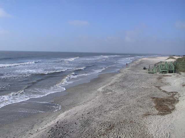
 ↑ ↓ Got a decently early start today at 8:20 but it didn't seem to help a lot. This section of
coast doesn't have a lot of excitement about it. Not that I was actually that close to the coast for most of the day. Best I
managed was to sneak into a park to snap a couple of pictures. I say sneak because they were not open and at this time of the
year I wasn't sure that they would. Anyway I wasn't about to pay an outrageous admission charge for five minutes of being
sand blasted while trying to snap a picture so I sorta' slipped under the barricade. I didn't even notice what the name
of the park was but reconstruction suggests that it was Folly Beach. I'll post a
picture of it and if you know you can tell me. Unless, of course, you are some sort of South Carolina cop and then I'll
declare the foregoing a work of fiction...
I stopped at the Sewee River Visitor Center and took a longish walk since the weather was, if not sunny, at least mild and non-liquid. The visitor center has a display habitat for the endangered red wolves but that seemed rather sad -- a sign posted near the animals' cramped enclosure assured that they were fed on "high quality dog food". Surely they could have done better than that for what used to be the major predator of the region. The remaining major predator seems to be the mosquitos which, despite the late date, were quite hungry and followed me for most of the walk.
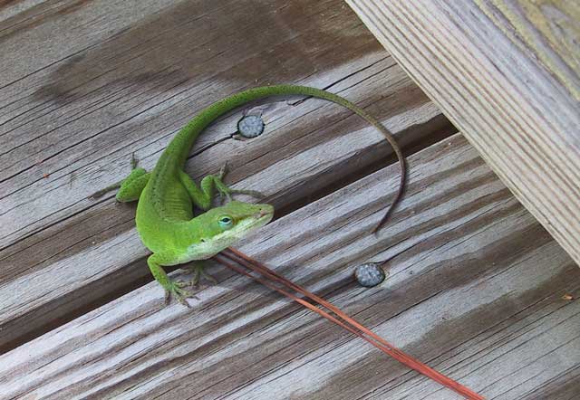
Probably the most interesting animal I saw on the walk was a green anole lizard which despite seeming to have a bad eye was still brave enough to walk out in front of me and pose for a picture. Most lizards aren't that courageous (or foolish), being nice sized snacks for most of their larger neighbors.
And that pretty well describes the day. I wound up in Myrtle Beach, a tourist spot which looks especially grim during the off season. I've been there during the peak when it seems to look like a continuous celebration of college spring break.
Day 3, October 13, 2003: Wilmington, NC to Washington, NC
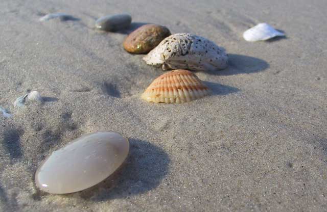
↑ ↓ I got an very early atart and fueled the Miata by 7:15 and by 8:30 I was at North Topsail Beach for a bit of a walk on a beautiful morning. There were a few others out for their morning exercise but the beach was pretty empty. I snapped a few pictures and got on my way again.
 Next stop was Atlantic Beach on an island off of Morehead City. The beach out there was a lot busier at
10:00 than North Topsail had been with a large number of fisher folk. Funny. I've never seen anybody catching anything while
surf casting and I've watched a lot of people doing it. Guess they might just do it as a pastime and don't expect to
catch anything at all but they do seem to sink a lot of money into the equipment. At the far end of the island is another of the
old fortifications, Fort Macon in this case. I walked
around there and snapped a few pictures but these forts are getting to be a bit repetitive. This one had some pretty brickwork
but that seems to be a common feature of them all. With no freeze-thaw cycles to speak of the bricks will probably last a long
time.
North Carolina has several locations where free ferries are provided rather than bridges. I caught my first one between 12:00 and 1:00 at Cherry Branch. This was a very quick crossing and including loading and unloading probably only took a half hour. I landed in the Pamlico area and started noticing the first definite signs of damage from hurricane Isabel. While crossing this agricultural area I noticed that some of the homes had piles of waterlogged furniture, carpets, and insulation stacked out front for pickup. I drove through the town of Aurora enticed by a sign advertising the Aurora Fossil Museum. The museum consist largely of a huge collection of fossilized shark parts, mostly teeth but since it was free I certainly won't complain about it. I actually bought a large fossil mako shark tooth from their gift shop although I don't have a clue what I'll do with it. One more bit of junk to add to the mass that I've collected over the years.
The next ferry crossing didn't work out as neatly as the first. I showed up at the Bayview ferry terminal about five minutes after a 2:20 departure and found out that the next one wasn't due until 5:45. This lead to a lot of riding around and time killing. I had the top down ever since leaving Aurora and was pretty sun and wind burned by the time the day was over. Because I was so late in getting across it seemed wisest to backtrack to Washington, NC to improve my chances of finding a motel since there looked to be little chance of finding one at a reasonable time if I kept pushing up the coast. I've covered 775 miles so far but since I really have no firm idea about how long the trip will be a bit of backtracking probably doesn't matter.
Day 4, October 14, 2003: Washington, NC to Virginia Beach, VA
↑ ↓ I got an early start leaving Washington, NC this morning. And, since the weather is forecast to be unsettled later on I was sure to fill the car before taking off. I was in Bath, NC by 8:00. Bath is supposed to be the oldest town in the state. For what it matters, the town was the home of the real Blackbeard the Pirate, Edward Teach.
 I pressed on up the coastal highway and before
noon arrived at the North Carolina Aquarium. Hmmm. What to say about that? Let me just
say that it is, indeed, an aquarium. Sadly not a terribly impressive one so far as I can say. Even the pokey little aquarium in
Chatanooga, TN outdoes it (in my opinion of course). So far as I have seen, no other institution can come close to matching the
wonderful aquarium at Monterey Bay, CA.
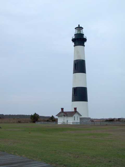
I guess I should say some more about the results of hurricane Isabel which hit this area recently. One major result was that the major, no make that only, highway running up the length of the Outer Banks was severed. The natural route for my "edge" route would have run up the islands starting with a ferry ride to Ocracoke. Since there was no way to do that short of using an amphibious assault vehicle and dodging the state police I took the easier path and drove further up the coast and covered only the shortest bit of the Outer Banks. Going this way meant that, if I was going to photograph the famous Hatteras Lighthouse, I would need to backtrack down the Outer Banks for some distance. As it turned out it was pissing rain when the time came to head south so I gave up on that idea and settled for a snapshot of the Bodie Lighthouse instead.
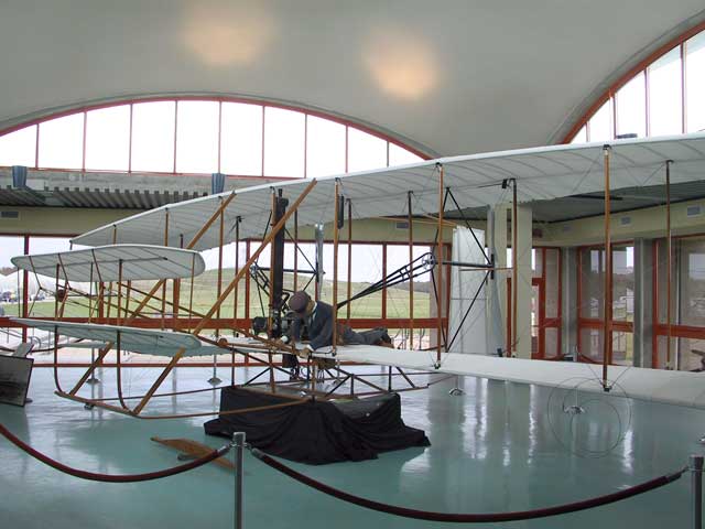
The portion of the Outer Banks I did drive was that which contains Kill Devil Hills, Kittyhawk, and the Wright Monument. I stopped for a pretty good lunch in Kill Devil Hills at Pigman's BBQ and then drove over to the Wright Monument. The monument was totally overrun by tourists even on a weekday. No doubt this is partly due to the upcoming centenary of the first powered human flight in 1903. The forecast bad weather finally came through. In fact it started the moment I had walked up to the monument on a big hill a long way from my car. The moment I hit the top the rain started and I headed back down finishing up in a torrential downpour before getting the car's door open.
A bit further up the highway in mid-afternoon I was planning to take another ferry. The Knotts Island ferry runs across Currituck Sound which would get me back on the truly coastal route I wanted. Unfortunately the ferry terminal was nowhere to be seen despite driving several times up and down the section of highway where it should have been. I gave in and asked the local postmistress who got me straightened out pretty quickly. It turns out that I had become, at least slightly, a victim of Isabel: the signs that should have marked the turnoff had been blown down by the storm. I made the longish ferry crossing as the rain poured down.
I continued on the other side and blundered around a lot of unmarked back roads in the rain until I stumbled upon the main road and got into Virginia Beach, VA at 4:30. Very desolate looking place in the rain during the off season when many of the lodgings and businesses close down. At least the room was cheap at $40. And it was literally on the beach with a good ocean view.
Day 5, October 15, 2003: Virginia Beach, VA to Rehoboth Beach, DE
↑ ↓ Left the "Diplomat" motel a little later than
intended. The motel has surely seen better days. It is a multi-story building, five if I recall, right on the ocean but shows a
lot of wear and tear and not all of it came about as a result of Isabel. I guess I shouldn't complain too much since the room
was cheap and didn't seem to be dirty.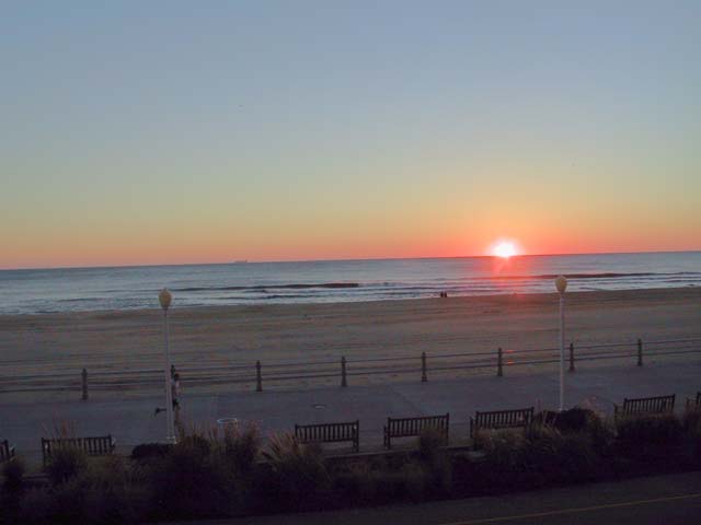
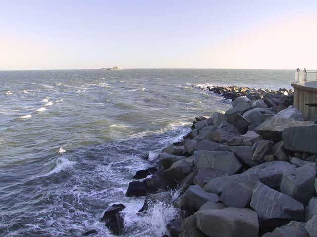
 I snapped a picture of the sunrise from the balcony and
it was quite clear which got me to wondering about the old rhyme about red skies vs. clear skies and when sailors should be
delighted or warned. If I remember correctly this should mean that it will get worse later on.
Just north of Virginia Beach is the Chesapeake Bay Bridge and Tunnel which crosses, naturally, Chesapeake Bay. It dives underwater twice on the way across, presumably to allow the largest ships to cross over while a couple of high-level sections allow smaller ships to go underneath. It was wickedly windy during my crossing but at least yesterday's rain is gone.
By 9:30 I was in "Historic Cape Charles" which stuck me as a place with nothing but history. The present was grim and appeared that it was on the way to becoming a ghost town with nothing but boarded up businesses to show.
Later I drove out to Chincoteague Island to look around. A rather pleasant place which made me feel a lot better than Hilton Head had earlier. At least this place has not been taken over, at least not totally, by either old or new money. In other words it was a mixed/real community. If you've heard of this place at all it probably is in connection with the annual pony roundup. On the way out I drove past Wallops Island, the NASA site, and intended to stop at their museum but as luck would have it, it was closed. Don't know if this was merely an example of my bad luck with schedules or some sort of security-related development.
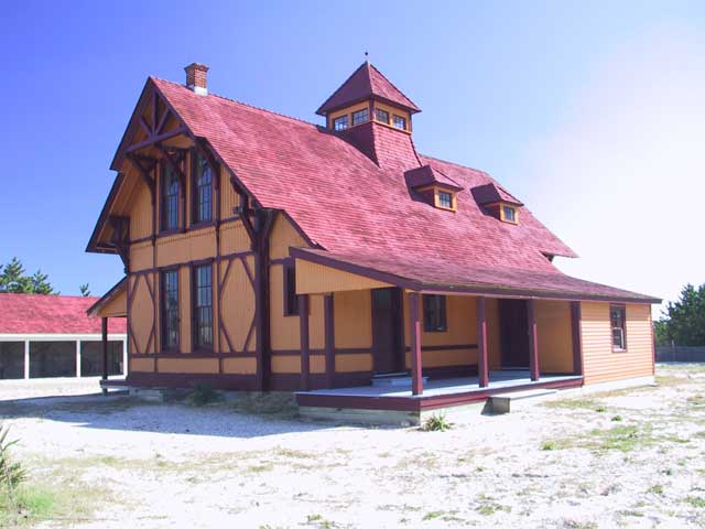
I crossed over the dividing line into Maryland at around noon and shortly thereafter I was in Delaware. The sudden passage through three states was entirely due to old political dealings which sliced up a rather short peninsula among three of the original states. The peninsula is, to this day, pretty sparsely populated (at least compared to what lay on the mainland) and remains quite rural/agricultural. Stopped at the Indian River Life-Saving Museum to look around. The old Life-Saving Service has quite an interesting history in this area. The wind was so wicked during my stop that it was about all I could do to open the door on their modern gift shop / entry building. Of course had I chosen to open the other door it probably would have been blown off its hinges. Wonder what that could mean for my "voyage" tomorrow?
I holed up in Rehoboth Beach, DE for the night in preparation for catching the Cape May Ferry in the morning.
Day 6, October 16, 2003: Rehoboth Beach, DE to Lakewood, NJ
↑ ↓ No real need to get moving early this morning so I left the motel at 8:00 and had a leisurely breakfast at Bob Evans—the heart attack inducing cholesterol bomb special. Then off to wait for the ferry with sufficient ballast in my belly. This time it is not a free one. In fact, since they seemed to think that this was still high season, they kept the fare high too at $25.00. The boat ride put me in New Jersey by 10:30.
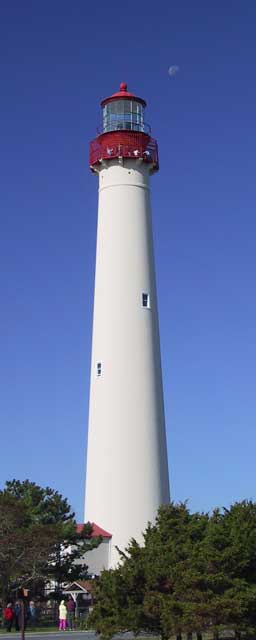 Took a break in the sunshine at
the Cape May Lighthouse although I didn't spend the money or
time required to climb to the top. I might have but there were an amazing number of tourists, including screaming children,
waiting for that privelege. A walk around, a few snapshots, and a look at the beach was enough. An accomodating ranger at the
information office was nice enough to give me a state map from her private stash on the condition that I pocket it and don't
announce the fact that I had gotten one. Seems that the maps are in short supply and that she had a hard time getting even a few
to keep "under the counter". I make it a practice to obtain a state map at the border whenever possible to save the bother of
digging the computer out of the trunk to use my mapping program.
I wandered around Cape May looking for fine old Victorian homes. Watching television had somehow given me the impression there were, if not thousands, at least hundreds of grand gingerbread palaces lining every street. As it turns out they are pretty thin on the ground once you start looking for them. I hiked quite a distance among the mazelike streets following a badly copied tourist handout and located a few attractive examples. At least the weather was warm and the wind had died down so the walk was enjoyable. Finished my browsing at around 1:15 and took off north to seek a stopping place for the night. Given the sunny skies and balmy temperature I put the top down for a couple of hours.
One place I needed to drive through was Atlantic City, NJ and I thought that it might be interesting to see all the wonderful changes that were supposed to have taken place there. I was last in the city during the 1965-66 period when it was a dirty depressing dangerous dump with bad streets. Well, I can say that today Atlantic City seems to be a dirty depressing dangerous dump with casinos. And the streets don't seem to have improved much either. Oh, I'm sure that for the lucky ones who are making a living from the casinos life is probably better but down at the level of the streets I drove through it looked to be the same. I did stop in at a casino and drop $20 into a slot just for the experience. I used to live in Las Vegas and then later I visited the city fairly regularly. The comparison between the two gambling centers is pretty stark. The Atlantic City casino I visited almost makes those in Las Vegas look like centers of high culture and refinement. One great touch in the casino I visited is that the noisemakers on the slot banks put out a sound like the wail of an industrial vacuum cleaner and seem to do so constantly from all I can tell. A real headache inducer. OK, enough whinging on that subject...
As I went north the weather started to degrade so the top went back up. To make matters worse the lodging was almost non-existant so I was forced to keep hunting until I finally stumbled across an Econolodge way up in Lakewood. Not that it was the least bit "econo" in price but by 6:30 almost anything would have done.
Day 7, October 17, 2003: Lakewood, NJ to Riverhead, NY
↑ ↓ Undoubtedly this will be a short account since nothing much pleasant happened all day. I have, if not a hatred for, at least an aversion to most large cities. And today was the New York day...
Thirty-or-so miles north of Lakewood, after breakfast, I decided that at 99,000 miles it was time for an oil change on the Miata so I stopped at one of the quick lubrication places along the highway and had them take care of it for me. On a whim, before leaving the garage I asked the supervisor how close I was to Fort Monmouth. He informed me that it was only a few miles away so I headed in the indicated direction and after only a few wrong turns located it.
 I had
attended a six-month training course at the US Army Signal Corps School at FM starting in 1965 and was curious to see how my
vague memories of the place matched up with current reality. I need not have bothered since nothing at all was recognizable.
Literally nothing. I can't say whether it is a matter of a massive dieoff of brain cells on my part or massive changes on
their part or some combination of the two but I might as well have never been there before. Before leaving I walked through their
communications museum then headed out into the grey drizzle and starting
north again.
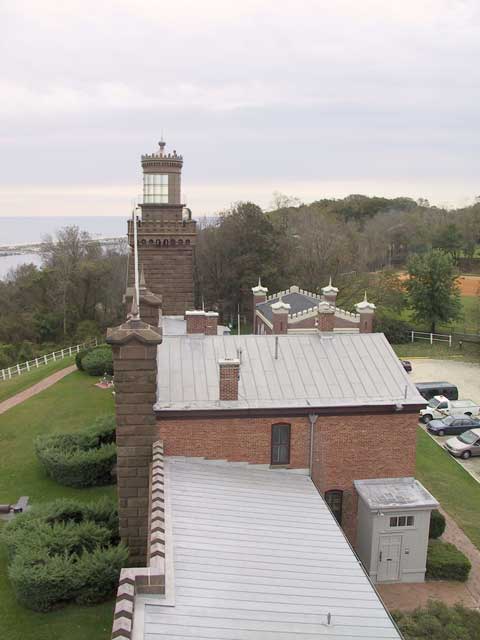
I stopped at the Navesink Twin Lights, a rather unusual example of the lighthouse art and science. They have made the original stone structure into a fairly typical museum but it is free and they allow visitors to climb one of the short towers to look around. By the way, if you ever do make the climb, pay attention to the sign which says "watch your head" because if you are over four feet tall you might well do what I did and have a dent in your head and a dull ache for the rest of the day.
Bashing your head on a heavy iron brace is one thing. Driving around New York City is another. Both are painful but somehow the former seems less so. Naturally I made efforts to avoid driving into the city itself and my clever plan was to head up the coast to the Amboys, zip across Staten Island to Brooklyn and up through Queens on I-495 and to continue out Long Island until I found a nice place to stay. Ahhh, the stuff that dreams are made of. What I actually did was to sink myself into a continuous traffic jam embedded in a massive highway con/de-struction project that seemed to start at the NY border and continue through Queens. A Miata belongs on the open road, not among a thousands of near-stationary trucks spewing toxins. A foul, foul drive...
After getting out on Long Island I discovered that there were bloody few places to stay along the way. And many there were already booked solid for some reason or another. Out near the very tip and quite late I finally found a motel that would deign to allow my presence in exchange for an exhorbitant amount of money. Even after talking them down by every means known to man the room wound up costing twice as much as any other for the whole trip. I guess that when one does not plan ahead far enough to make reservations this is what happens.
From the room that night I made 11:00AM reservations for the cross-sound ferry in the morning and hoped for the best.
Day 8, October 18, 2003: Riverhead, NY to Kingstown, RI
↑ ↓ Got out of the motel a bit past 8:00 and headed toward Orient where the ferry terminal resides. It isn't far. Amazing how empty this part of Long Island is! I stopped at the Horton Point Lighthouse but it was closed for the season so all I could do was walk around and snap a few pictures. As it turns out I must have done something wrong that evening when I was moving pictures from the camera to the computer and not one of those pics seems to have survived. Oh well. You can look at their website and see what it looks like. Their photography is probably better than mine anyway.
 Because of the shortish drive and short stay at the lighthouse I managed to
make it to the ferry terminal pretty early so I tried to get them to allow me on the 10:00 run rather than making me wait for the
booked one. They put me into the standby line and I waited it out by writing a few postcards and even started composing a letter
on the computer. I decided pretty quickly that using my oversized laptop while sitting in the Miata wasn't very productive
and gave up on it. When the standby line started loading I got my hopes up but they stopped loading with the car in front of me.
So goes my luck.
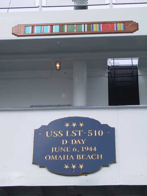
Got loaded onto the ferry Cape Henlopen for the 11:00 run and got prepared for the crossing which was was expected to last 1½ hours. The rules on the ship don't allow passengers to remain on or even access their vehicles during the crossing. Had I realized this I would have taken my computer out of the trunk and worked on my letter at a table in the lounge. As It was I spent most of the time wandering around the deck freezing and hoping for something to photograph. The ferry has a bit of history, having started its life as an LST in WWII and having taken part in the D-Day landing. That kept me hoping that they had done some really serious modifications and updates to the ship over the years since my recollection was that LSTs in general didn't have a great reputation.
The crossing was totally uneventful but I will mention one thing. If you wish to avoid snide remarks, please skip to the next paragraph. [begin rant] Queued up to grab a hotdog and Pepsi at the snack bar on the ferry I couldn't help but noticing (and photographing) two signs by the cash register. Why is it that the attendants would be trying to collect "tips for college" when the other sign suggests that they didn't learn very well in grammar school? Isn't that when little grammatical niceties like the proper use of apostrophes and the differences between contractions, plurals, and possessives are taught? [end rant]
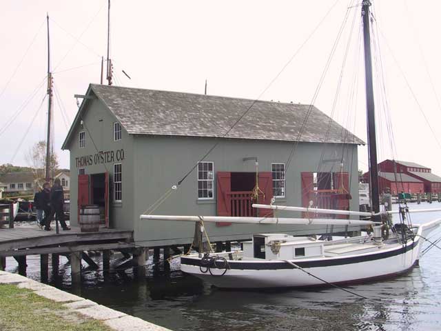
The first stop, no make that the only stop, on the other side of the sound was Mystic Seaport in Connecticut. A hard place to describe adequately, it is a sort of historical site sort of a theme park sort of an educational site sort of a museum. They do have a great collection of historical boats and ships and if one is at all interested in such things it may well be the best such site in the country. At least I can't think of another with a better collection. Rather than trying to describe it at great length but inadequately I'll just refer you to their website.
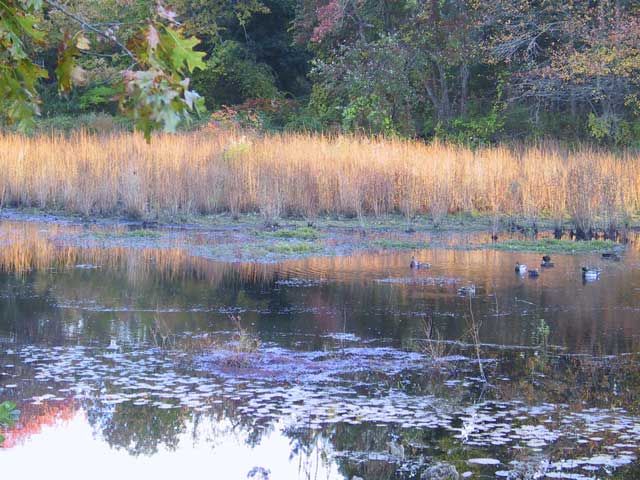
After Mystic Seaport I headed further up the highway looking for lodging. Again, this proved to be pretty sparse in the area I was travelling. I finally found a cheap, and cheap for a reason, motel. Pretty funky little place so I won't mention any names. The first room I got had a little balcony overlooking Sandy Pond which was full of ducks. Sadly it (the room, not the pond) was more that a bit lacking in livability and sanitation. I complained and was put into a different, possibly no better, room that lacked the view of the pond. Oh well. All I wanted to do was catch some sleep...
Day 9, October 19, 2003: Kingstown, RI to Hampton Beach, NH
↑ ↓ Today was spent, in essence, circumnavigating most of Cape Cod. For all that travel I have very little to report: Cape Cod is very pretty. Cape Cod seems to have no fast food restaurants of the "normal" sort. Cape Cod seems to have no "chain" motels. Cape Cod is, to my great surprise, rather agricultural. But the weather was uniformly grey and overcast and that may have dampened my enthusiasm a bit.
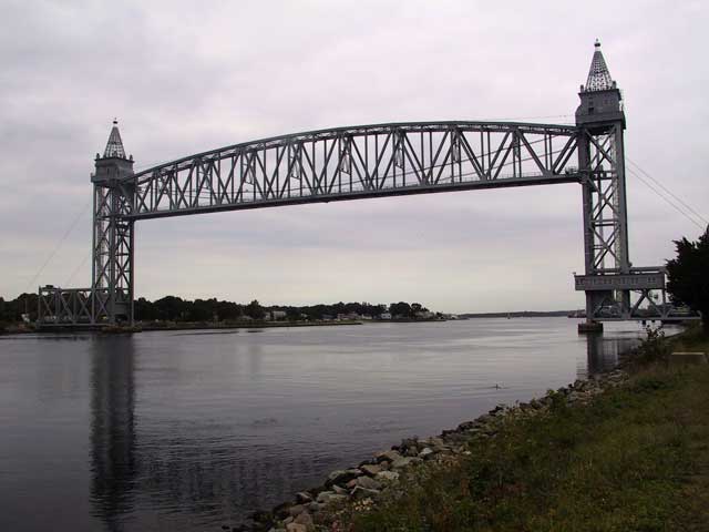
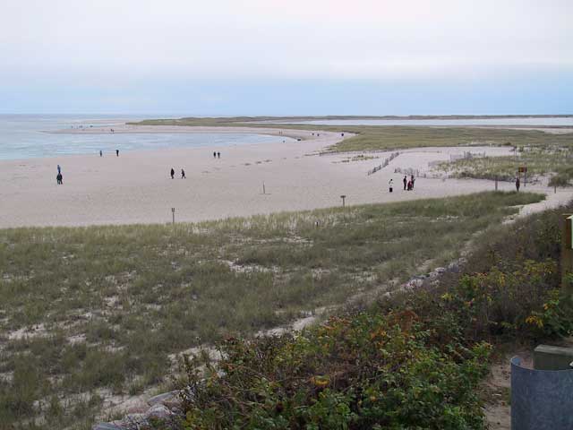 I walked out onto
Horseneck Beach early in the day despite it being officially
closed for the season but the grey windy day wasn't conducive to much beyond nasal drips and numb fingers. Later on I drove
along the Cape Cod Canal and saw this amazing vertical lift
draw bridge unlike anything I've seen before. Truly huge. And it appears to be quite famous among those who follow both
bridges and railroads since it is actually a railroad bridge. Sorry to say that it wasn't moved during my time there but it
probably would have been impressive in motion.
Stopped later at Chatham Light during a slightly brighter period. It is still has an active Coast Guard detachment but the light itself is far from impressive. But the area is quite popular with tourists nevertheless but the coast and dunes below the light seem to be the real attraction, not the light itself. The temporary brightening of the day was short lived and it began closing down and drizzling soon afterward. It is starting to look more and more like I picked the wrong time of year for this drive although these weather fronts are always unpredictable. It might be beautiful tomorrow. Let's hope so.
At first writing, this page totally failed to mention Boston. Given the amount of whinging I did about New York City that may be surprising. In fact I was prepared for the worst when it came to Boston given the stories about traffic snarls caused by "The Big Dig" and the legendary aggressiveness of the city's drivers. As it turns out, the drive through Boston turned out to be totally uneventful and passed almost unnoticed. The only real memory of that part of the drive is driving in a longish tunnel and then popping up to pass onto a really beautiful new cable-stayed bridge which crosses the Charles River. Well done, Boston.
Found a decent looking motel for the night in Hampton Beach, NH. This area is another of those beachfront communities that pretty much go dormant after Labor Day. That meant hunting for a very long time to find a restaurant that remained open during the off season to feed the locals. They exist in a core of the city that is pretty well hidden from the tourist areas but I located a good one eventually and had a lovely bowl of clam chowder with freshly baked rolls and a Heineken for dinner.
Day 10, October 20, 2003: Hampton Beach, NH to Glen Cove, ME
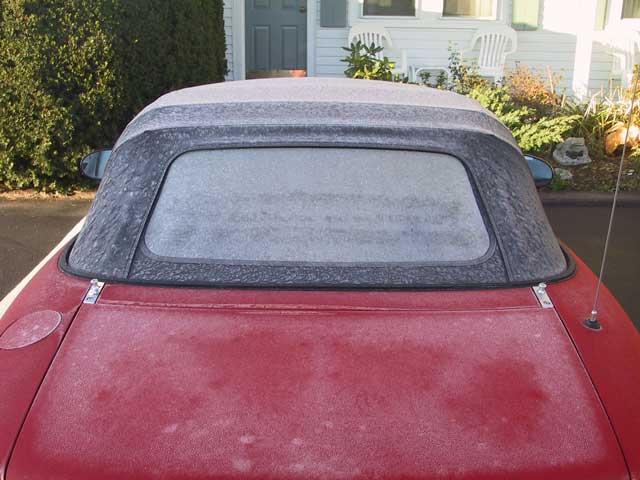
↑ ↓ A change for the better! A bright clear sunny morning. Of course clear skies allow the air temperature to go into a freefall. The result was a Miata well covered by a layer of frost. Despite that the blue skies seem to motivate me to get going.
 Heading up the coast the first stop
was Fort Constitution.
Nothing grabbed my interest there and I haven't included even one picture of it. The next stop was a lot better. Surely the
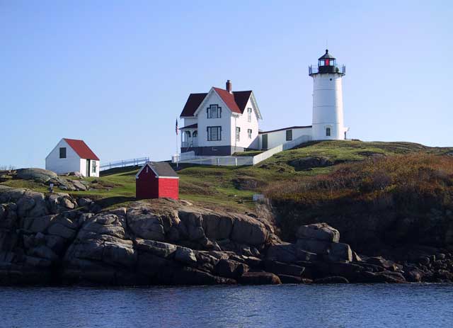
"Nubble" Lighthouse (actually the Cape Neddick Lighthouse but nobody seems to
use the real name) in York, ME is one of the prettiest I've seen so I climbed around the rocks across the water and snapped a
lot of pictures. An admission: I prettied up the picture shown below by editing out an annoying power pole and lines but even
with them it was a beautiful scene.
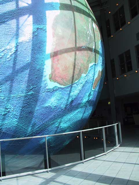
Further up the road a couple of hours later I happened to notice the big building belonging to DeLorme, makers of maps and mapping software. I used their Street Atlas 2004 software to do a lot of the planning for this trip. I used a different mapping program from DeLorme on my first trip and did so along with a GPS receiver to track my progress in real time. This time I decided that it was probably not worth the hassle of keeping a notebook computer running in the passenger seat and trying to watch it while driving. One great feature at the DeLorme offices is Eartha which is the largest rotating world globe. An amazing bit of work.
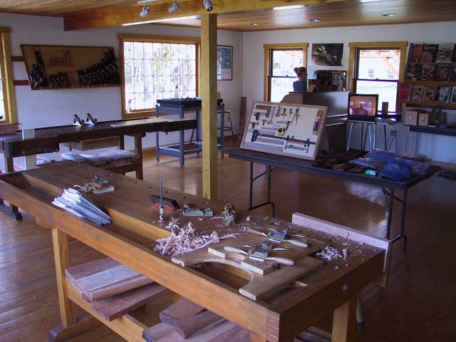
A couple of hours later I stumbled across a name that is known to woodworkers around the world: Lie-Nielsen Toolworks. Under some other conditions it might have been dangerous for me to even consider stopping here but my credit card balance was already heartstopping and even a small tool might not have found a place in the trunk. But if you are a woodworker reading this account and you don't already know about this company it would be worth your while to look at their offerings. Even if you, like I, can only afford to look it is an education in the art of tools.
I continued up the road looking for a motel and when I drove past this one I just knew that it was the one as might anyone with Irish roots (or pretentions). The Claddagh Motel in Glen Cove, Maine is run by Alex from Galway and Siobhán from Dublin and is absolutely over the top in a couple of ways. First is the Irish motif in the office which probably makes St. Patrick's Day in your local pseudo-Irish pub look subdued. The other is the decoration in the rooms. Have you ever seen a fully flowered motel room with piles of lace pillows on the bed? Neither had I but that is what I found there. A good motel and a good value run by good people.
Maybe today's successes mean that things are looking up...
Day 11, October 21, 2003: Glen Cove, ME to Quoddy Head, ME to Ellsworth, ME
↑ ↓ I opened yesterday's account with great expectations under frosty but clear blue skies. Today I awoke to heavy grey skies pouring heavy grey rain and my mood quickly headed in the same direction.
 But even with the
weather, today is the day—the day I make it to the north-easternmost point in the contiguous 48 states. My
actual destination was a matter of a little personal debate but considering that one milepost on the original 1997 drive was Cape
Flattery in Washington, the north-westernmost point, West Quoddy Head in Maine seemed an appropriate destination.
Part of the drive today was through vast stretches of wild blueberry. Really barren at this time of the year. In some ways they look like areas in Alaska where various low berry plants grow and that means that the climates are probably similar. That suggests that the wind-driven rain might switch over to wind-driven snow without warning. It is snowing in other areas of Maine right now and some higher elevation areas had a noticeable accumulation last night. So things could be worse I guess. Sometime during this stretch the Miata crossed the 100,000 mile mark which I had meant to note since it happens so infrequently but somehow the rollover wasn't noticed until 70 miles later.
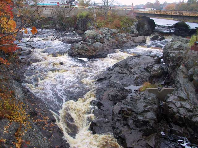
Drove into a little town named Machias and noticed a sign pointing to the right showing the way to "Bad Little Falls Park" and I just had to see this. Indeed there were falls. And they did look pretty bad. But I didn't find out until much later what the connection was: the name Machias in the local aboriginal language means literally "bad little falls".
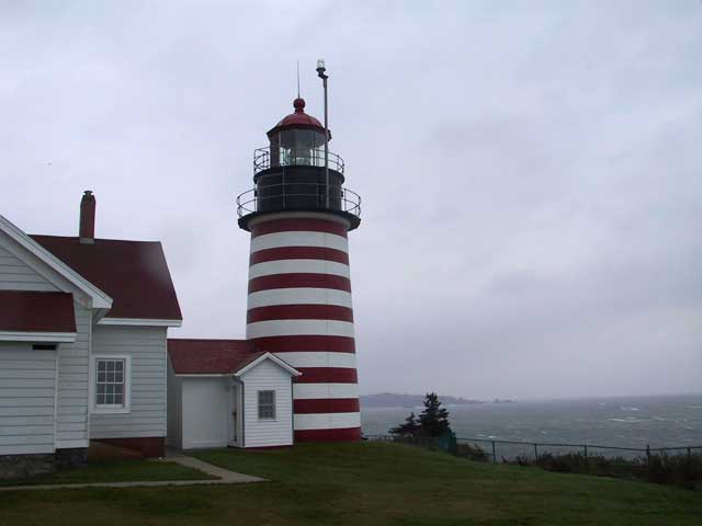
At about 3:00 I finally made it to the agreed destination, the West Quoddy Head Light on the Bay of Fundy. Appropriately the wind was blowing just short of a gale but fortunately the rain had slacked off to the barest drizzle allowing me to make the run from the designated parking area down to the lighthouse. The park itself was officially closed but nothing was going to stop me from recording the event. It turned out to be difficult to get a good snapshot of the scene. Not so much from the moisture in the air but because the buffeting winds made a steady exposure tricky. But I eventually got my proof and headed back to the car glad that it was over.
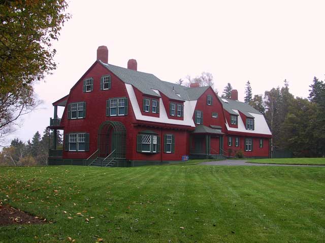
Just for sake of completeness and to say that I did make it to the extreme I crossed over into New Brunswick, Canada by crossing the Roosevelt Memorial Bridge from Lubec, ME. I drove quickly up the the nearest identifiable landmark with happened to be FDR's "cottage" at Campobello. Total time in Canada was 23 minutes by the car's clock. I had to undergo a regular inquisition crossing back into the USA though and was expecting to have to produce a passport, DNA sample, and a note from "dubya" before being allowed back in despite having been gone for less than a half-hour.
So, my self-imposed quest was done now and I could go home. But along the road back I had determined to stop at a few of the old Shaker communities along the way. And there was a place in Vermont that was purported to produce about the best aged cheddar in the USA. So, even though I'd be driving home on a faster route than the one that brought me here the trip wasn't quite finished.
The night was spend in Ellsworth, ME but during the drive there the rain which had slacked off at Quoddy Head came back with a vengeance. Huge wind driven drops sound just like flying pebbles when they hit the car and for a while it seemed but it must surely be hail. But no, it is just massive balls of water travelling who knows how fast splatting against the car's body. Just a few? more days to go now...
Day 12, October 22, 2003: Ellsworth, ME to Tilton, NH
↑ ↓ The "mission" is complete and the former intention to
stay on the edge of the USA is a thing of the past. There are a few places that I want to visit and I will try to make my way to
all of them but the route will be chosen via computer for the quickest drive. If for no other reason than the weather which is
forecast to get worse and to do so quickly. To quote the entry in my notes for today They forecast snow for tonight. What
have I gotten into here?
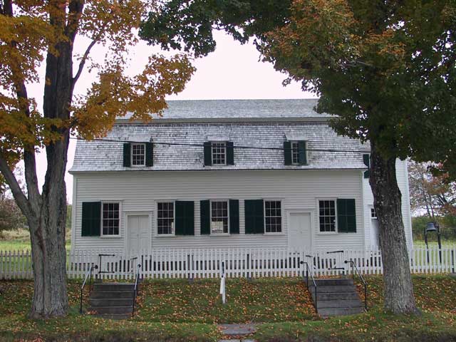
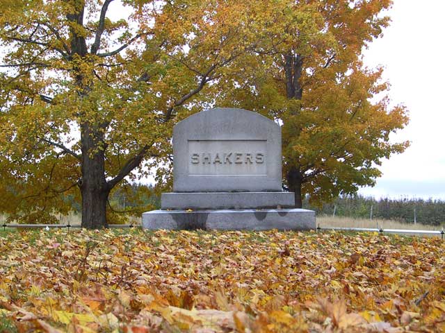
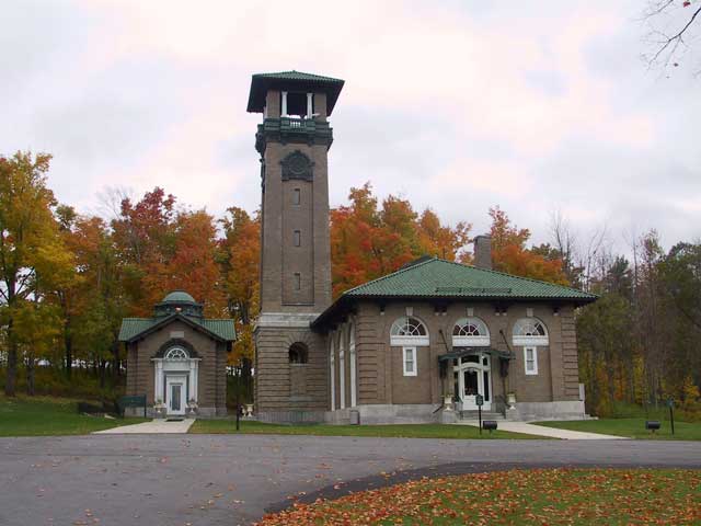 First things first. My
intention is to visit some of the Shaker communities in New England because I have an interest in their crafts, furniture, and
designs. Since there is still one active Shaker community at Sabbathday Lake, Maine
and since I am here in Maine the decision to drive there was obvious. But since I was intent on travelling at speed from now on I
quickly headed for highway I-395 in Bangor and aimed toward my destination. Sadly, the calendar was not on my side in this and
the community was effectively shut down to outsiders at this time of the year. Oh well, I did look around and snapped a few
pictures without committing actual trespass.
Next stop was a short one at Poland Springs, the place where the bottled water originates. They have a visitor center but don't offer any views of the modern bottling facility which might have been of interest to me. Oh well, I got to use their restroom which was a priority at the time.
The next scheduled stop was at Canterbury Shaker Village and I got close close to it before 4:00 but there seemed to be no motels or other facilities near the turnoff. Just to make sure I got a room for the night in case the weather turned foul I continued down the highway to Tilton, NH. Backtracking to Canterbury would be simple from there. The updated forecast for tonight definitely calls for snow and thoughts of what happened to me in the Yukon Territory in 1997 were hard to avoid.
Day 13, October 23, 2003: Tilton, NH to Greenfield, MA
↑ ↓ Weather forecasters are often wrong. But they got it right yesterday with the forecast of snow. I awoke in the middle of the night and looked out the motel window to see it falling on the parking lot to lightly cover the cars. And when I awoke it was still coming down. But all was not lost. Because the ground temperature was not below freezing the snow there was merely slush despite the 4-inches on the Miata and as long as the ground didn't get much colder...
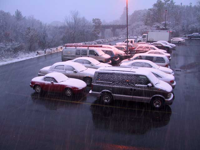
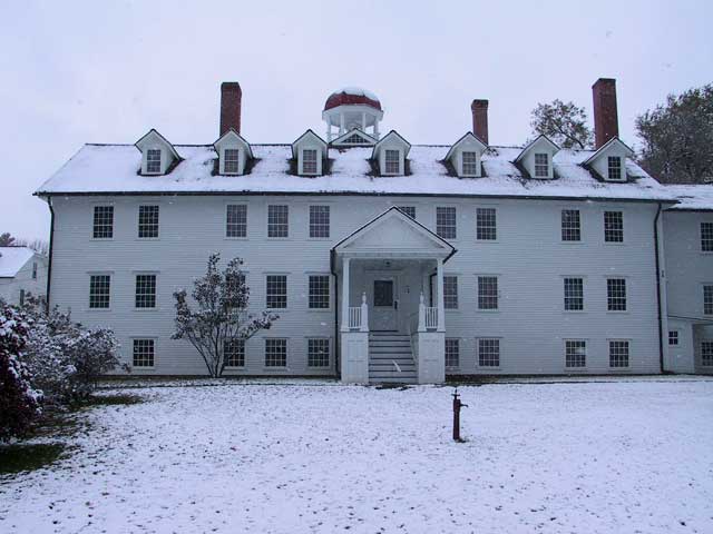 I cleaned off the
snow, grabbed a quick breakfast, and headed back up the highway toward Canterbury. The road conditions weren't wonderful and
visibility was bad when a big vehicle decided to pass raising a wall of slush to cover the Miata but traffic was light enough to
minimize that hazard. I made it to Canterbury quite quickly. So quickly in fact that they were not due to open for nearly an
hour. An early arriving employee was nice enough to invite me into the visitor center to wait.
The Canterbury Shaker Village has both guided and self-guided tours but during the off season they fall back to offering only the guided variety. I went out with the first group and the group was shown around several of the key buildings on site while the guide gave a narration of Shaker life and history. Nothing against the guide, he was doing well, but I've heard and read all of the information many times and wished that I could just wander about on my own. But that was not in the cards. Even worse, being forced to stay with the party meant being forced to obey their rules the most onerous of which forbids interior photography. This is a real pain to me since one of the main reasons I go to these museums is to gather ideas for projects and photos are the best way I can record them. Oh well...
My original intent was to stop next at the Enfield Shaker Museum which is not very far up the road but, due to the unpredictable weather and steadily increasing cost of the trip it was chopped from the itinerary. That meant that the next stop was to be for cheese. And cheese, at least in this part of the world, means Vermont. When it comes to award-winning cheese producers that tiny state has a major surplus. I had chosen one producer based on awards, press coverage, and web research so the next stop was to be Grafton, Vermont. As luck would have it this stop almost turned out to be a bust thanks to the intervention of the Vermont highway maintainers who, for some reason had completely blocked off the one highway I was depending on to get to Grafton. And they had failed to provide any sort of signs to show a different way. I assume that they figured that anybody who really belonged in Grafton already knew which back roads to take to get past the construction and they weren't about to waste time and money with signs.
I finally did manage to deduce a detour route on my own and to get into Grafton a at 3:45 and stopped at the restaurant which had the visitor's information sign out front. The woman there told me where the cheese company lay but also told me that they close at the tick of four. No exceptions and no reprieve. I sped through town and arrived at the company's parking lot with a couple of minutes to spare only to discover that they were already locked up tight. Defeat snatched from the jaws of victory! I finally did manage to get the attention of a store worker by going in the back door where the UPS driver was loading up and asked for entrance pointing out that they had jumped the gun and closed before the appointed hour. My pleas gained me admission to the front room for a few minutes and even allowed me to buy a bit of cheese but with the stipulation that they would only accept cash because they had already started processing the credit card receipts. And cash was not something I had much of at the moment. So, the great blocks of aged cheddar I had imagined carrying off as gifts and to enjoy myself were reduced to a few small one-pound blocks. The cheese went into the trunk wrapped in my heavy winter coat. Given the regional temperature this would be an effective short-term refrigerator.
For really great aged cheddar I can still recommend Grafton Village Cheese to you despite their inconvenient hours. Besides, they have a web store which is how I'm going to replenish my supply. The two-year old cheddar in the black wax is truly superb (I'm eating some even as I write this). And I'm going to go for some of the three-year cheese next. And then maybe work my way up to the five-year variety which I imagine might just be enough to make one's teeth spin in their sockets.
Headed off down the highway to Greenfield, Massachusetts in preparation for the next day's scheduled stop. The back roads and higher elevations had a few icy patches but the weather was not likely to be a problem since I would be heading steadily southward from now on and remaining on the major highways.
Day 14, October 24, 2003: Greenfield, MA to Wilkes-Barre, PA
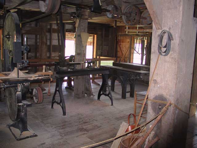
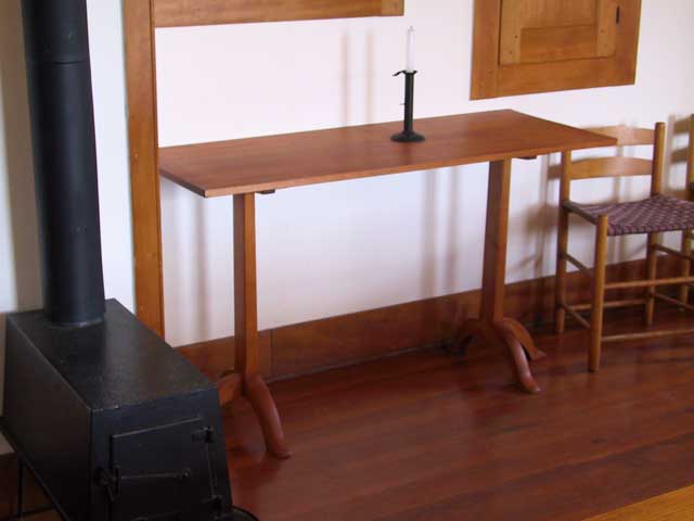
↑ ↓ A leisurely late start to a cool clear day but I managed to make it to my first stop at Hancock Shaker Village by 9:30. This one, like Canterbury yesterday, changes its operations during the off season and only offers guided tours. Not really what I wanted but one takes what one can get. Fortunately, unlike yesterday, this museum has a more enlightened viewpoint on photography and allowed me to snap to my heart's content. Since the furniture and artifact collection here is especially fine I went a bit crazy and made a lot of images. A couple of pieces of furniture here are justifiably famous for their elegant lines and proportions. The table pictured at the bottom of the page is one that has been widely emulated.
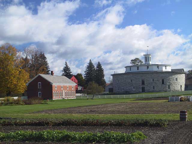
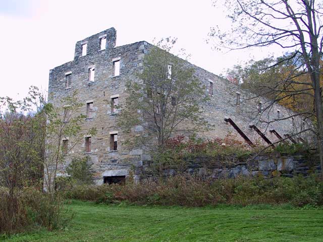 No mention of Hancock would be complete without including the round stone barn which still stands. The barn was the
most important fixture in the Hancock Shaker's dairy operation and is a real tribute to their creativity. The barn was, in
essence, a machine finely tuned to allow the efficient feeding and milking of the maximum number of cows by the minimum number of
workers and underwent numerous changes over its working life as conditions changed and new laborsaving ideas were added.
Since it lay only a few miles down the road, albeit in a different state, I decided to a very quick peek at the Mount Lebanon Shaker Village. They had closed for the season on the day I set out on my trip so there was no way that I could get inside for a look. This is doubly true since many of the buildings had been bought and were in active use by a private prep school and they don't seem the sort that would welcome scruffy looking tourists with open arms. I snapped a few pictures of some building exteriors and called it quits. Two buildings are of special interest. One is the meeting house which has a rather unusual curved roof. The other is the North Family's great stone barn which exists now minus interior structure and a roof. I believe that there are plans afoot to restore that building and it should be an amazing sight when complete.
I set off by the fastest route determined to make as many miles toward home as I could before it got too late. Nightfall found me in a motel in Wilkes-Barre, Pennsylvania. And that friends, is that. I managed to travel the intended route to the planned destination and then managed to visit all the intended sites on the way back home except for Enfield. I'm tired, the car is dirty and is starting to smell a bit, and I just want to go home and get back to normal whatever that might be.
This is the last of the "On the Edge — Redux" pages. On October 25th I stopped at my mother's home at the opposite corner of Pennsylvania to say hello and deliver some of the cheese stash. On October 26th I finally headed home to Tennessee to recover. Total mileage for the 16-day drive: 4662. It seems likely that this will be the last of these trips unless true madness strikes and I suddenly decided that life will not be complete unless I drive the entire northern border of the USA to "close the loop"...
This website does not use cookies or javascript and collects no user information.